
Berlin High Trail via the Mörchenscharte

The transition from late summer to autumn often brings incomparable impressions to the high mountains of the Alps. The grass on the slopes is already taking on a yellowish-brown hue. The now significantly shorter days, however, offer longer periods with a low sun and flat light, which sculpts the landscape vividly. Long tours, on the other hand, already require the use of headlamps at dusk. In return, the weather is often more stable and there is less threat of thunderstorms. For all these reasons, our small group wanted to go on one last two-day tour on the Berlin High Trail towards the end of September, before the high-altitude huts closed for the season.

Since we liked the Berliner Hütte and its surroundings so much the year before, we chose it again as our place to stay overnight. It is located in the middle of the glaciated high mountain world of the southern Zillertal Alps. After having walked the so-called “king’s stage” of the Berlin High Trail over the Schönbichler Horn the previous year, this time we planned the section in the other direction, from the Berliner Hütte to the Greizer Hütte via the Mörchenscharte. The entire Berlin High Trail covers a good 85 kilometres in about a week and overcomes around 6,600 metres in altitude. However, there are also numerous valley access points, so that the stages can be walked in parts or with individual variations.
In glorious sunny autumn weather, we hiked leisurely up through the Zemmgrund to the Berliner Hütte and were able to enjoy the last rays of sunshine on the terrace before the sun disappeared behind the ridge. I climbed a bit further up the path towards Schwarzensee to use the last sunlight in the upper valley floor for photos. This was followed by a cheesy-beautiful sunset with alpenglow.

The hut team looked after us with their usual warmth and good food on this last weekend before the winter closure. The listed hut with its magnificent furnishings, wood-panelled dining rooms, the carved bar and the reception hall with its red carpet impressed me once again. In and around the hut, there are always new masterful handcrafted details to discover and anecdotes about the history of the hut to read or be told by the hut team. In the large hall, we enjoyed the hearty meal with a good red wine.
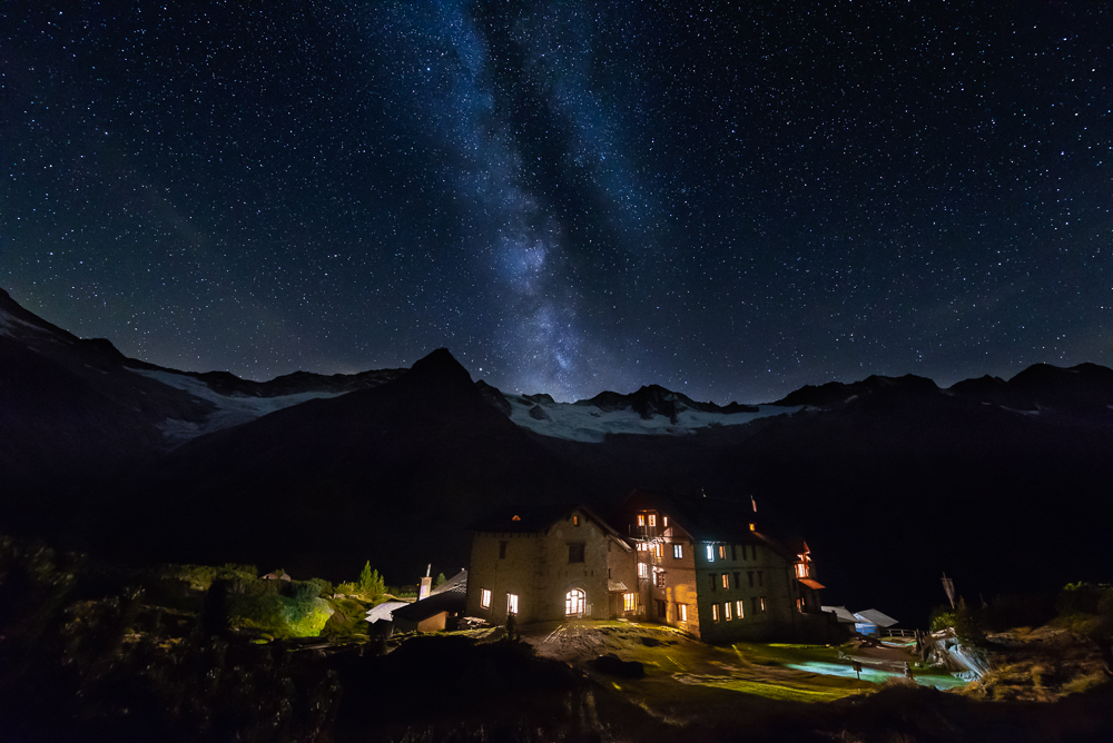
When the twilight was over and the dark night had set in, we marvelled at the magnificent starry sky in the now cloudless sky. The Milky Way rose exactly vertically above the horizon. With an app like PhotoPills, you can determine the position of the Milky Way and stars and plan photo tours accordingly. I, on the other hand, am more of a “photo taker” who takes photos within the framework of planned hikes with the given conditions. Nevertheless, the app can still provide important insights on site, for example to determine an optimal viewpoint and the exact direction in which the sun and moon rise or set. Now the fleece gloves also did their job, as the night was already frosty and working with a tripod and long exposure takes its time.

The following morning, we started early into the already sunny but still frosty day on the stage of the Berlin High Trail to the Greizer Hütte. We followed the ascending path first through mountain pines and later over gently sloping grassy hillsides. The path is paved with large stone slabs over long sections, which makes for pleasant walking. After about half an hour, we reach the moorlands of the Schwarzsteinmoor, which are well worth seeing. Embedded in them are small, dark tarns in which Waxeggkees and Großer Möseler are reflected. The high valley widens once more below us into a broader valley floor, across which we can look at the impressive end of the valley with the summit panorama from the Zsigmondyspitze, the Mörchenspitzen, the Schwarzensteinkees to the Berliner Spitze.

The glaciers themselves have retreated far; even the high amounts of snow from last winter were once again disproportionately melted by the hot summer. Below the bare ice lie the smooth rocks polished by the ice, as well as the scree slopes of the lateral moraines already colonised by plants, which give an idea of the former glacier level. The next highlight along the route, the Schwarzensee, then invites us to take our first rest. After that, the path runs significantly steeper over scree and stone slabs into the Roßkar and finally over boulders on the last few metres to the Mörchenscharte.

The view back shows us once again the great touring area for mountaineers and high-altitude hikers around the Berliner Hütte, which can still be seen deep down in the valley: Turnerkamp (3,418 m) and Großer Möseler (3,480 m) in front of the Waxegg and Hornkees glaciers. The Ochsner (3,107 m) rises strikingly on the right, while the Hoher Riffler (3,231 m) and Olperer (3,476 m) appear in the background. That’s the appeal of the high trail – great panoramas and yet demanding sections of path in high alpine terrain – at 2,872 m, the path reaches a considerable height again at this point. Only the crossing over the Schönbichler Scharte reaches an even higher point at 3,060 m.

The view to the other side of the Mörchenscharte shows the Greizer Hütte deep down on the opposite side of the valley. It is towered over by the Kleiner and Großer Löffler (3,379 m). Having reached this highest point of our hike, it was time for the next break. Loosen the thighs once more and lace the boots tighter, because now followed a 1,000-metre descent. This passed through all zones of the high mountains again: from the world of snow and ice over steep rock and scree slopes, on serpentine paths over grassy slopes and mountain pines, as well as short, rope-secured sections down into the valley, to the so-called Floitengrund. With the hut always in view, it was easy to estimate the current altitude reached. Who doesn’t know the feeling that as the distance covered increases, the remaining stretch seems to stretch longer and longer. Especially when the rest of the route, the whole valley down to Ginzling, now comes into view.
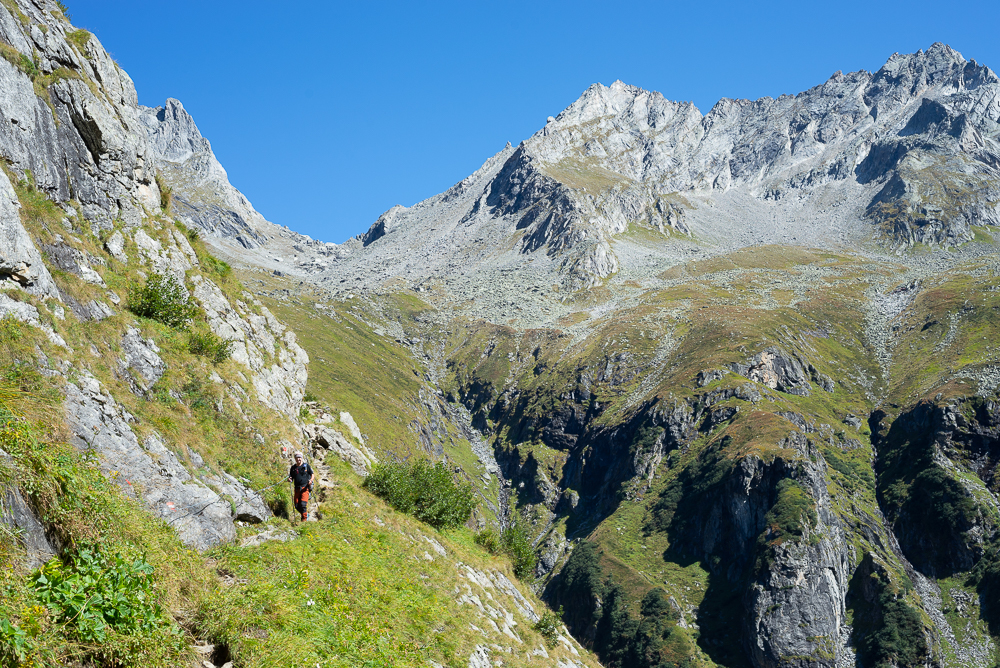
For hikers on the Berlin High Trail, the short but steep counter-ascent of 400 metres in altitude to the Greizer Hütte begins. We, on the other hand, turned valley-wards to tackle the remaining “slog”. At least the Steinbockhütte snack station and the Tristenbachalm offer two places to stop for refreshments, although for the former there were still around 6 km to cover. But on such a glorious autumn day and with the scenic route, this was a pleasant diversion and the subsequent cold beer well deserved. Once sitting, we found it hard to pull ourselves together to walk the last hour and a half. At least one person also had to pick up the car parked at the Gasthof Breitlahner. Therefore, we combined the necessary with the pleasant and let the hut taxi take us all the way back to the car.


Leave a Reply
Want to join the discussion?Feel free to contribute!